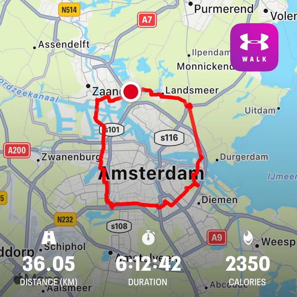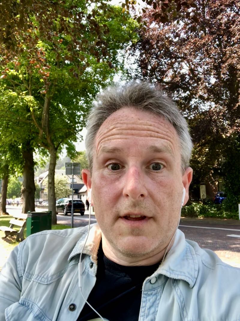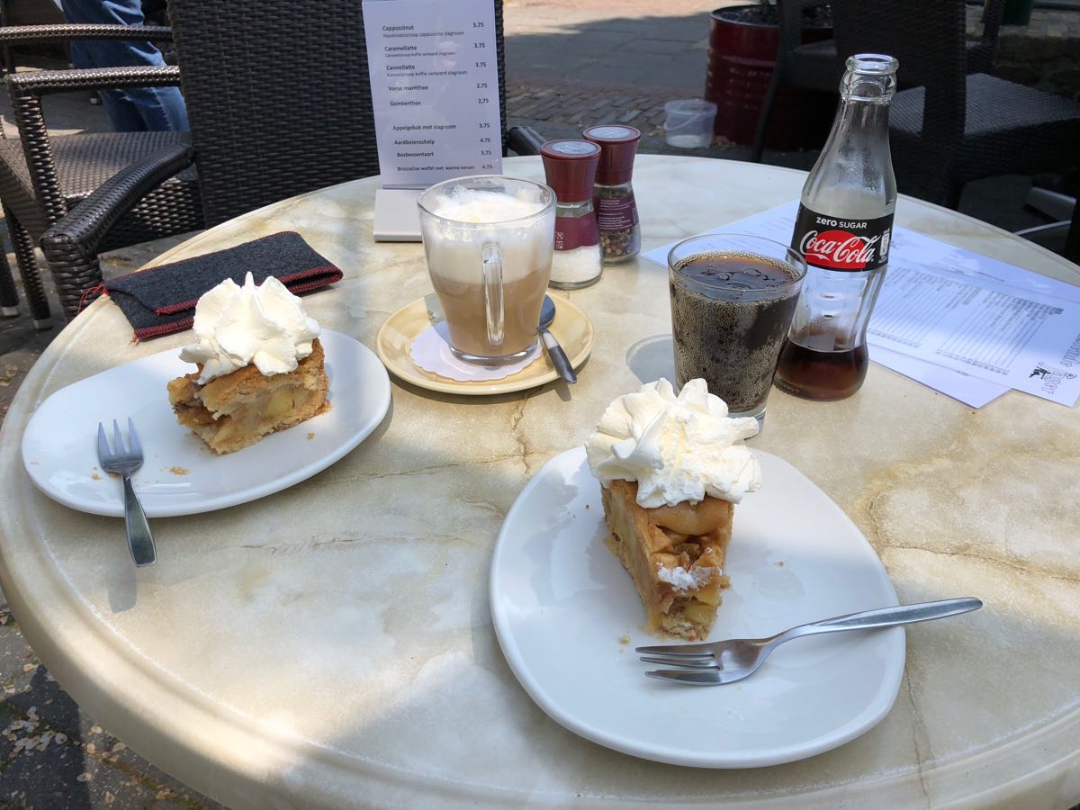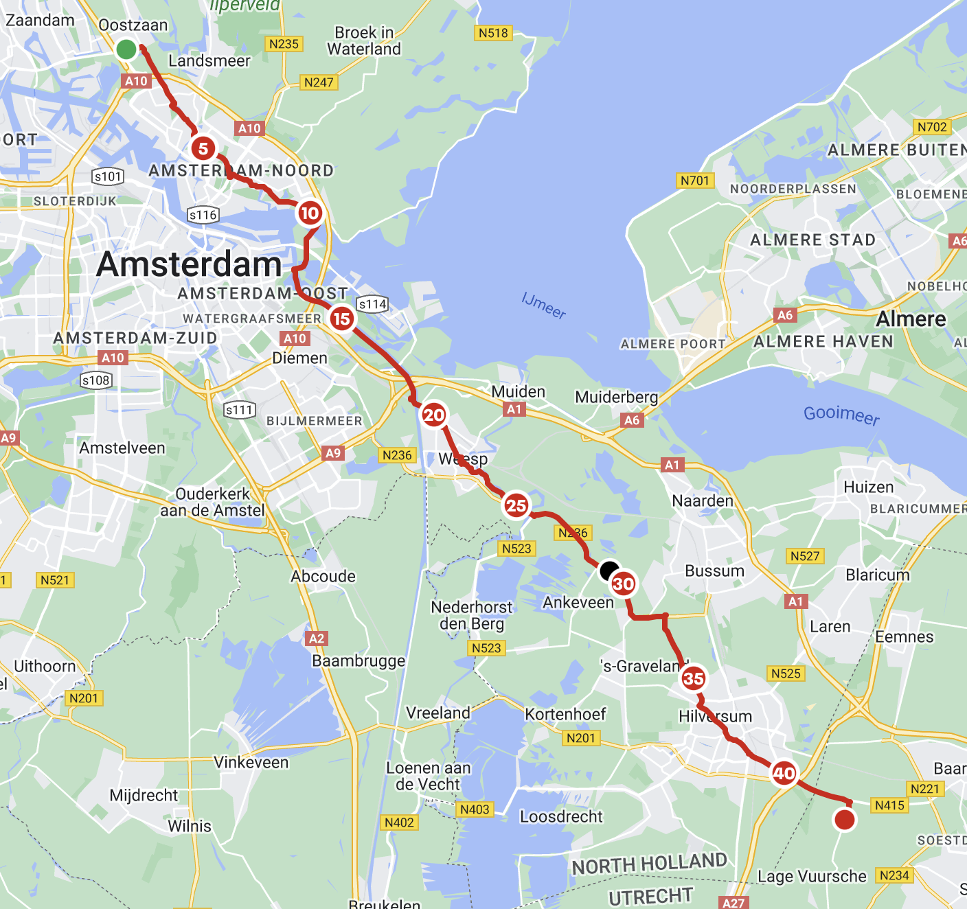
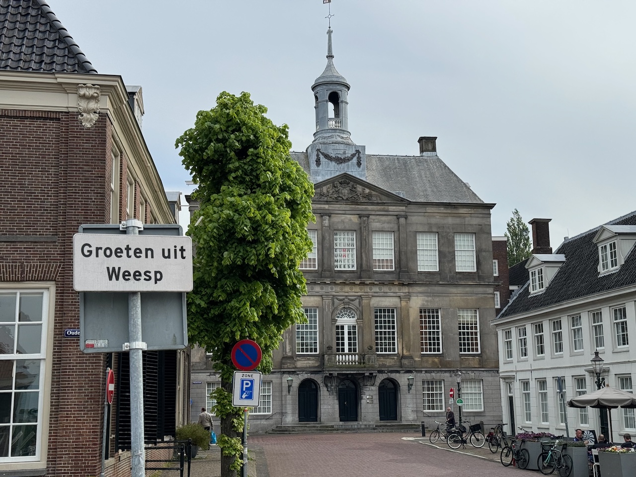
Actual walking time 6:44:06, total elapsed time 7:44:01 because I was generous with my breaks. (Last year: 6:32 and 6:59 respectively. I was in better physical shape last year.) I stopped in the centre of Weesp at the half-way mark for about 25 minutes to have some breakfast, then a 20 minute stop at the Gamma DIY store near ‘s Graveland for a toilet stop and a cold drink (about 32 km), and finally a 15 minute rest just outside of an Albert Heijn in Hilversum (about 37km) for another drink and a snack. Finished up at the Theehuis ‘t Hooge Erf in the Lage Vuursche forest, which is just under 42km door-to-door, so I walked past it by about 500m to complete the full marathon distance, and then doubled back.
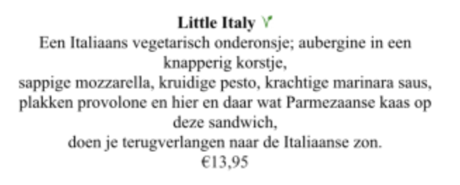
Abi met me for a mid-afternoon lunch. I had their “Little Italy” sandwich, which was amazing, although I was in a mood to appreciate any food by that point. Slices of fried aubergine fried in a crispy breadcrumb coating, rocket leaves, resting on toasted bread that had been topped with marinara sauce and melted pecorino and mozzarella cheese.
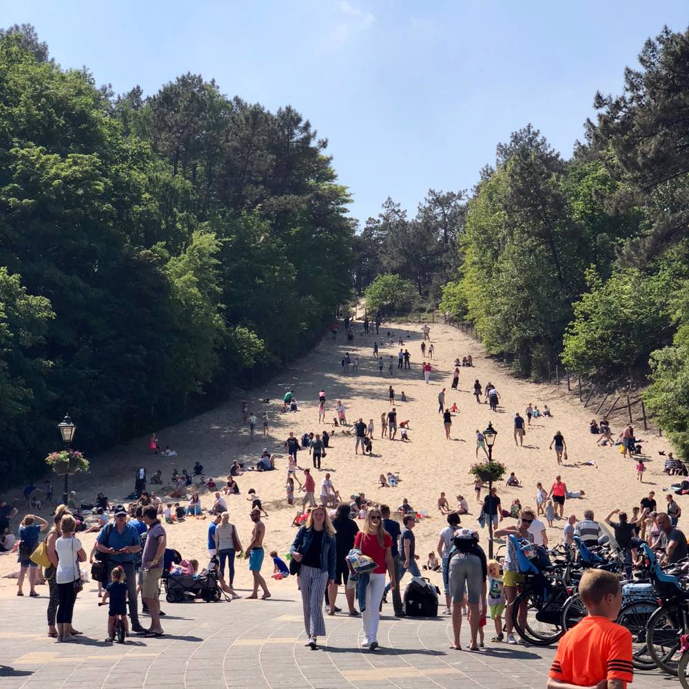
I usually do these marathon walks in April or early May, when the weather can be pleasant, but not too hot. A nice dry day around 15° is just about perfect. In April of this year all my free weekends were very rainy. Earlier this week it started to get hot (25°), and I felt that I needed to get the walk in before it was too late. The weather forecast for yesterday was decent, but there was a chance of rain by 14:00, so I made sure to get out early, about 06:45, just after sunrise.
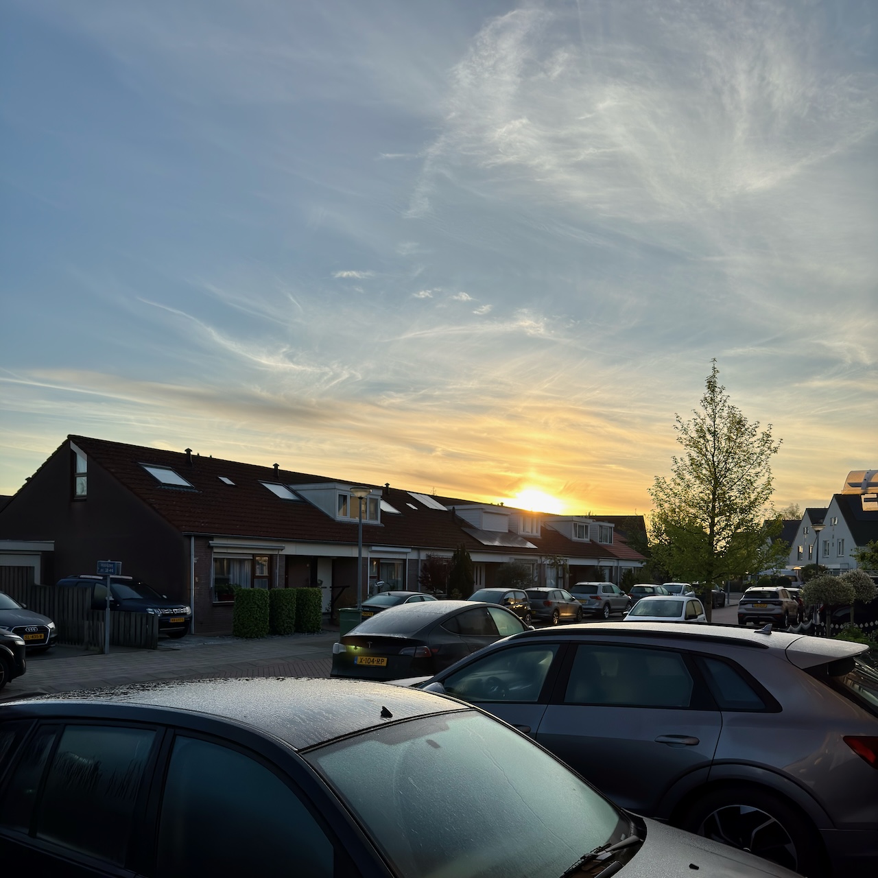
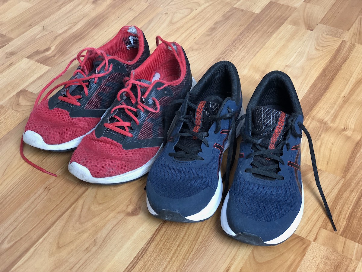
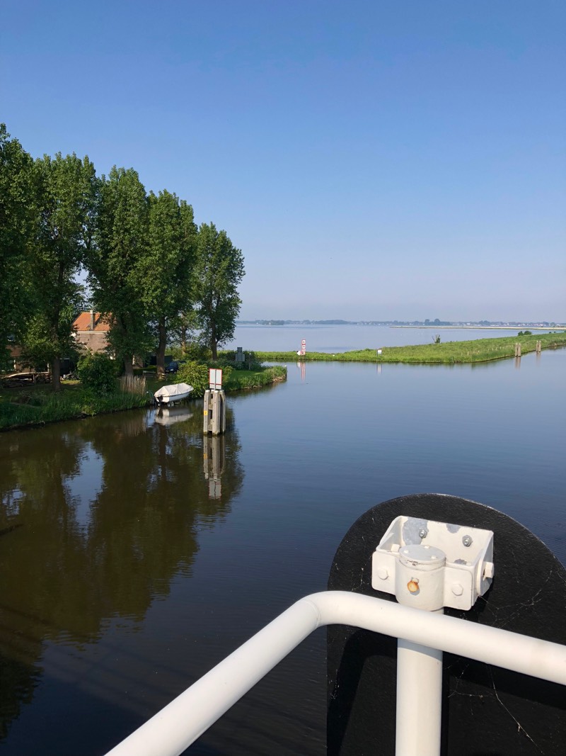
It was a lovely clear morning, and it stayed that way all the way to Weesp. I stopped once to re-tie my laces and tape up my heels, because there was a bit of friction. Last year I stepped up my walking shoe game from Asics Patriots to Asics Gel-Pulse 13s. (They were good shoes, but the upper wore out quite badly.) This year I’m walking on the Asics Gel-Pulse 15, which have a very different sole than the 13. They’re nice.
Last year I used http://sortyourmusic.playlistmachinery.com/ to make myself playlists of music of specific tempos, to help me keep a good and constant pace while walking. When I tried to use that tool this year, however, it wouldn’t save playlists to my Spotify account any more. (I don’t think the tool is actively maintained, and the Spotify API keeps moving on.) Instead of tempo playlists, I ended up listening to the selection of albums I happened to have downloaded to my phone. Last month I accidentally left my Airpods Pro behind in Scotland. I’m using my backup/sleep buds now, a set of Soundcore Liberty 4 NCs. They’re OK. But Apple Music opens up whenever I connect them. I decided to just roll with it, and listen alphabetically by artist. Here’s what came up:
- Couple of songs by Aerosmith
- Blood Moon by Apes & Androids
- Couple of songs by Arctic Monkeys (I hadn’t noticed before that in “Fake Tales of San Francisco” the tempo increases at points throughout the song…)
- All The Lights in the Sky and Modern Synthesis by Area 11
- “Monster” by The Automatic
- Grinning Streak by Barenaked Ladies
- Bad Blood by Bastille
- Hello Nasty by Beastie Boys
- 18 Months by Calvin Harris
- “Word Up” by Cameo
- In a Tidal Wave of Mystery by Capital Cities
- The Lady Killer by CeeLo Green
(This is far from all my music library in the first three letters of the alphabet… it’s just whatever I must have had synced to my old phone, and then got copied across when I moved to my new phone last year?) Anyway: BANGERS and I was quite happy to walk to them, and not worry too much about tempo. I had a bunch of podcasts ready to go, last year and this year I found that listening to music gave my mind more space to wander more easily.
Last year I had just recently bought an Apple Watch (series 8), and was still (mostly) enjoying it – although reading back I can see that I did recognize the niggles. Over time those niggles became full-blown annoyances, and I sold it a couple of months ago to someone who would enjoy it for what it is. Just as I want my TV to be a dumb screen without smart features, I want the thing on my wrist to be a simple sensor package. The Apple Watch is a very needy and greedy device. It tries its best to grab your attention in any way it can, starting with how it claims a spot in your daily routine for charging it, and then carries on with never-ending notifications. It felt like every time I would explicitly turn off some kind of alert, another feature I neither needed not wanted would start reminding me of its existence.
So now I’m rocking a simple Garmin Vivosmart 4 – not even the very latest model. It runs for 4-5 days on a single charge, and it has refreshingly few settings to make it stay perfectly quiet. If I want to skip a song, I tap an earbud rather than my wrist. It’s perfectly fine.
Again, I walked without any kind of backpack or attachments – I relied on the fact that this is Noord-Holland, and I’d be walking through towns and villages, where it would be easy to find food and drink. I did bring a stress ball for clenching and trying to reduce the edema in my fingers. It might have helped a bit? At the end of the walk I was definitely more tired and achy than last year – I weigh more than last year, and I haven’t been very good at keeping up my daily walks. My feet were mostly OK throughout the walk, but I developed a blister in the last 5km from Hilversum to the forest, and that had a knock-on effect. My right knee hurt quite a bit for most of the rest of the day, but it seems fine again after some anti-inflammatories and a night’s rest. Reminder for next year: the practice in the month leading up to a big walk does make a difference.